Analysis of MSE Retaining Wall
Project Description
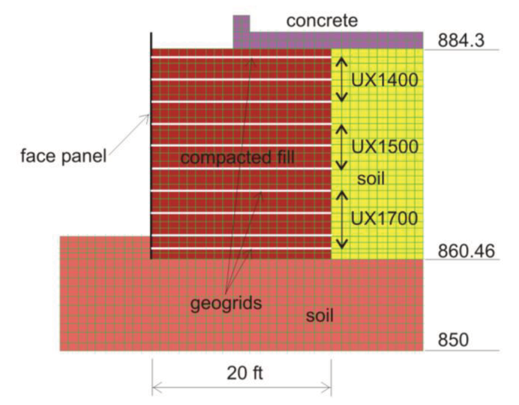
A section of retaining wall H on Trunk Highway 41 (TH41) south of the junction with TH212 in Chaska, Minnesota, "pushed out" following significant rainfall during construction. The rainfall event occurred prior to the pavement placement with the fill material exposed.
The movement (horizontal displacement) of the wall that occurred after the rainfall event was permanent and visible.
Itasca's Role
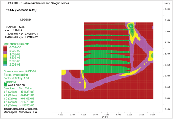
Numerical simulations were carried out to investigate the mechanism that caused the wall movement and to assess the effect of the wall movement on the stability and performance of the wall. Short-term stability (during rainfall) was analyzed for the designed geometry with two flood water levels considered.
Analyses were performed to establish the hydrostatic water level that caused measured horizontal displacement of the wall and to establish the critical water level at which the wall would fail. Long-term wall stability was assessed by performing factor of safety calculations for the deformed wall geometry, with installed sidewalk, and including traffic and earthquake loading, as well as accounting for the effects of creep on reduction in geogrid strength.
Project Results
Itasca determined that the observed wall movement likely resulted from the combination of two effects:
- rise of the water table in the fill; and
- seepage of water from the top, combined with migration of the fill material.
We determined that sagging of the geogrids, inferred from the settlements on the surface, have a relatively small effect on the factor of safety. The observed deformation (rotation) of the wall was predicted to have no effect on long-term stability and the wall factor of safety based on present conditions. Future rain events could result in further loss of fines through the wall and thus a buttress was added to the lower half of the wall.
Project Image(s)


